For conservation practitioners and land managers
Mesic Analysis Platform
Restore water where it matters most. Identify, prioritize, and monitor conservation and restoration across the sagebrush biome's mesic resources — wet meadows, springs, seeps, and riparian corridors. A Working Lands for Wildlife tool.
Why they matter
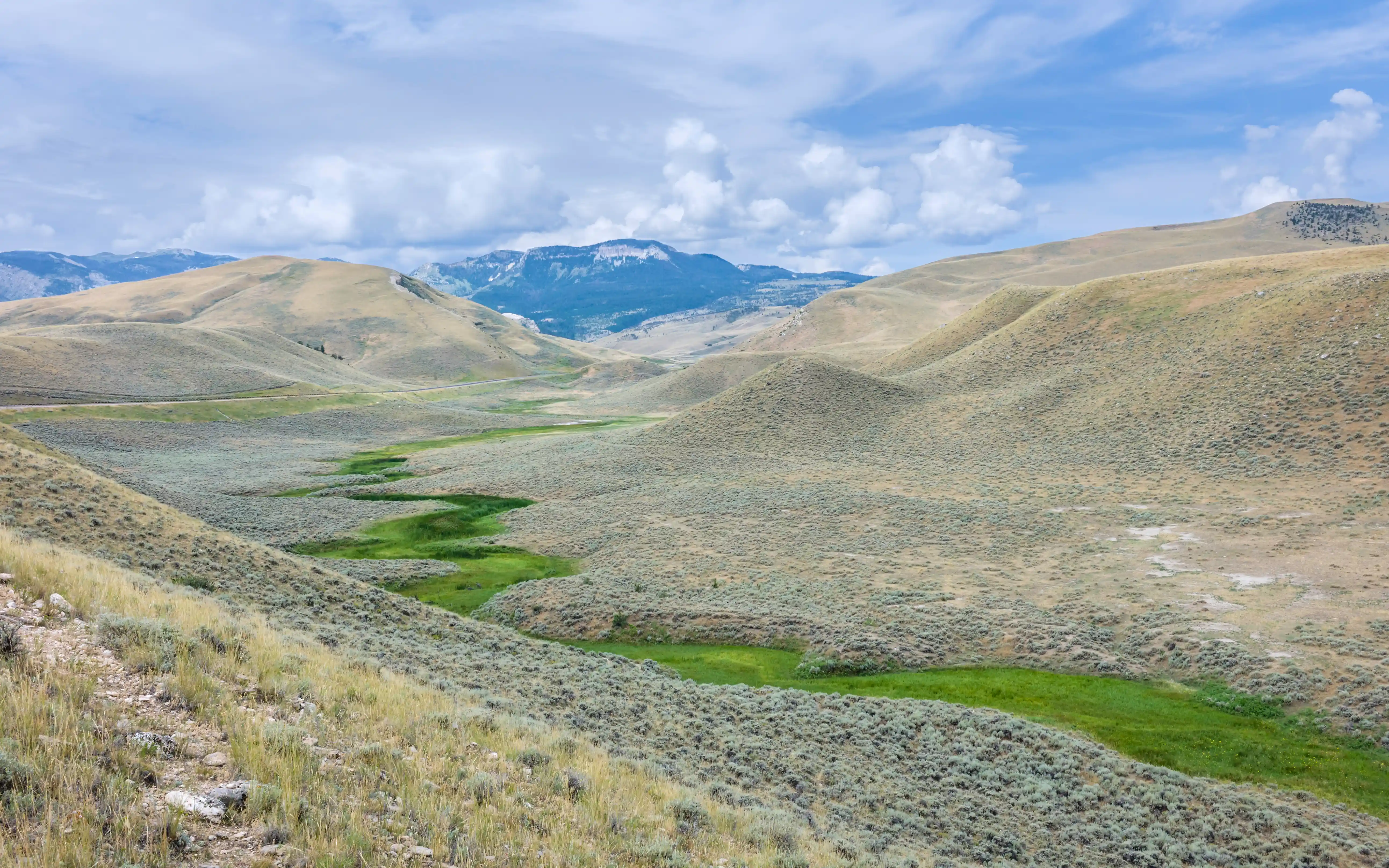
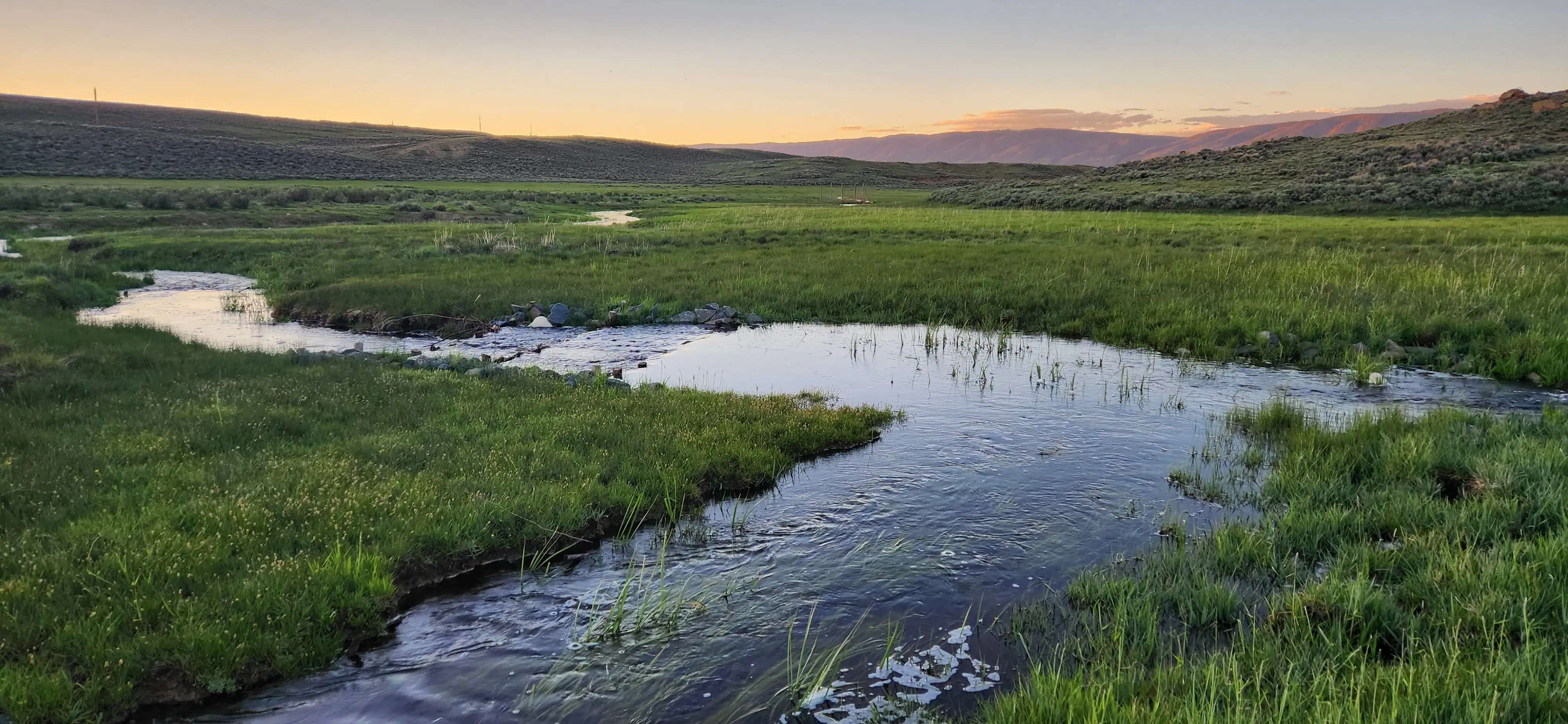
Mesic Resources Have An Outsized Impact
Though they occupy a small footprint, mesic areas are foundational to summer water availability, wildlife habitat, and restoration success across the sagebrush biome.
0%
Of The Landscape
Mesic resources make up less than 2% of sagebrush landscapes but are the primary source of water during the dry summer months.
0%
On Private Lands
Three-quarters of mesic resources sit on private working lands, making partnerships essential to conservation.
0%
Of Wildlife
Though small in area, mesic resources support the vast majority of sagebrush wildlife.
How it works
From Landscape To Stream Reach
Three integrated tools for mesic conservation and restoration.
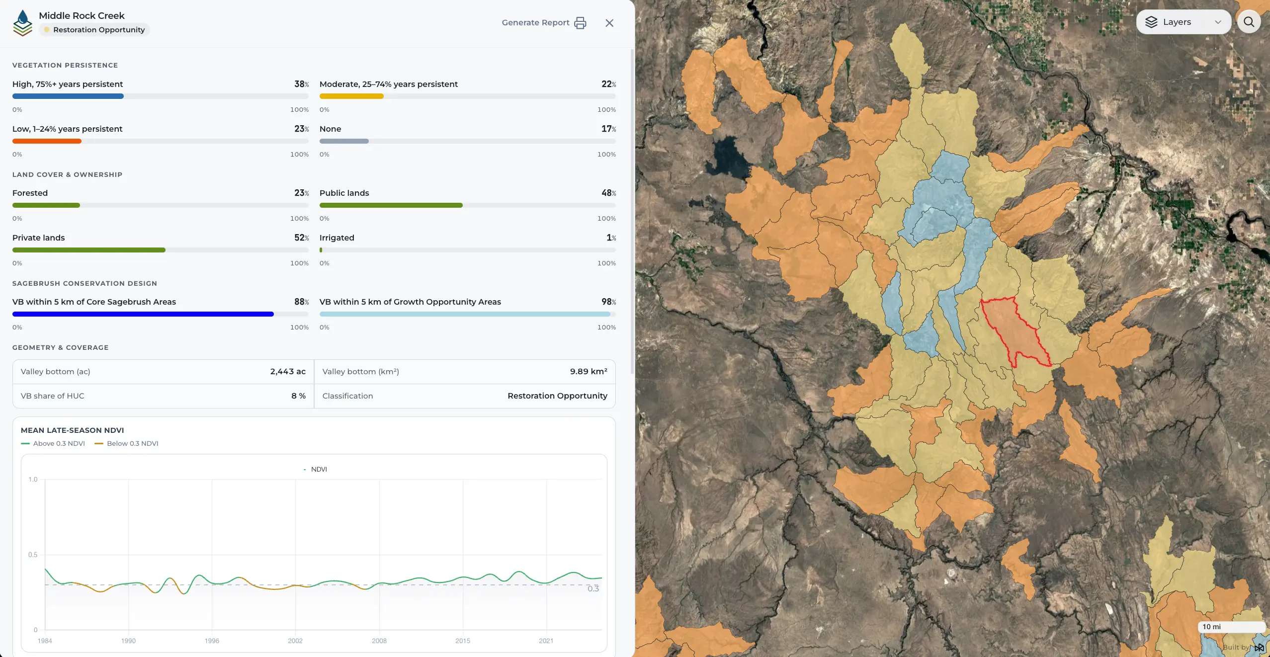
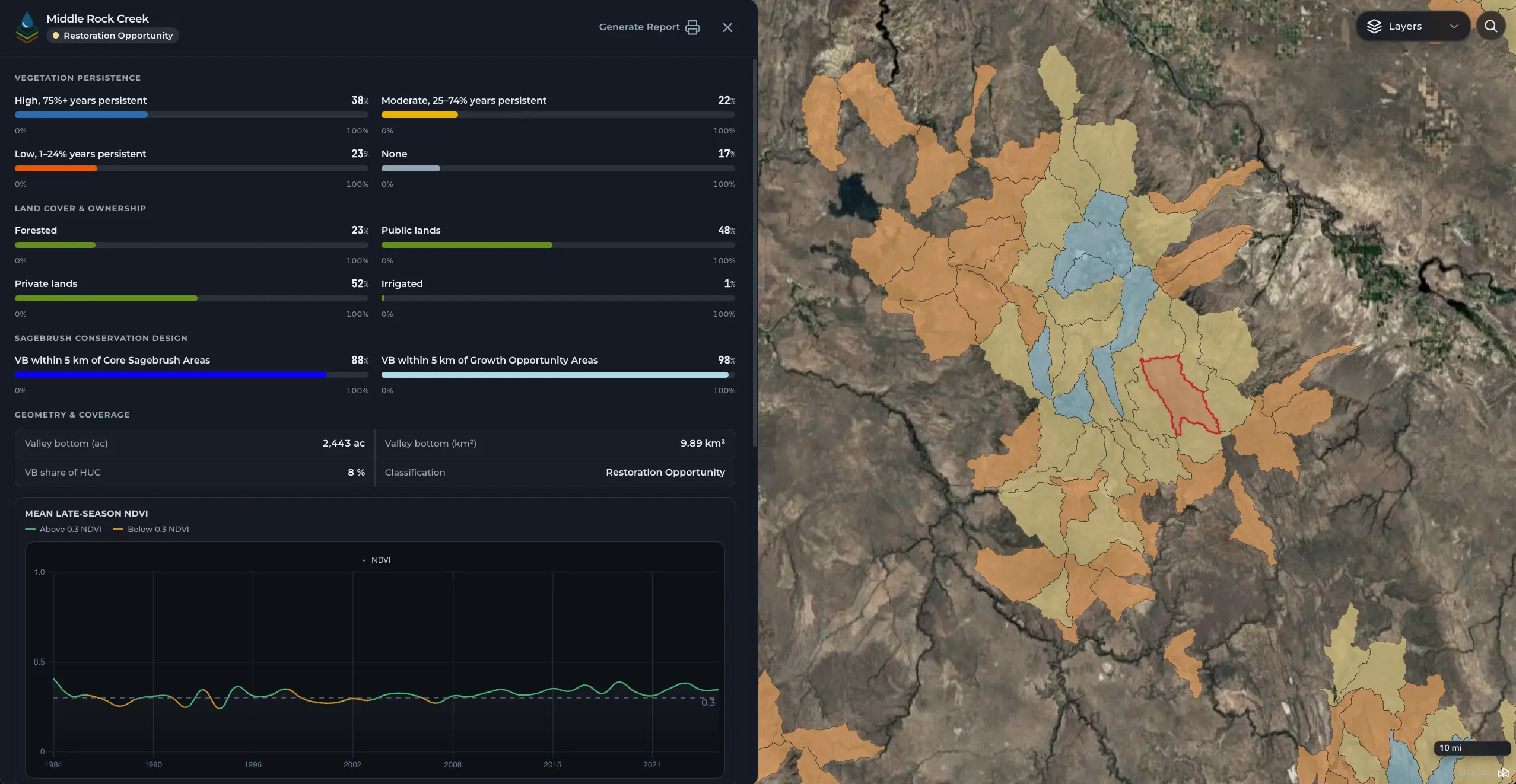
Find the watersheds where mesic restoration aligns with the Sagebrush Conservation Design (SCD). Combines 40-year mesic persistence data with SCD maps to show where restoration will most benefit sagebrush ecological health.
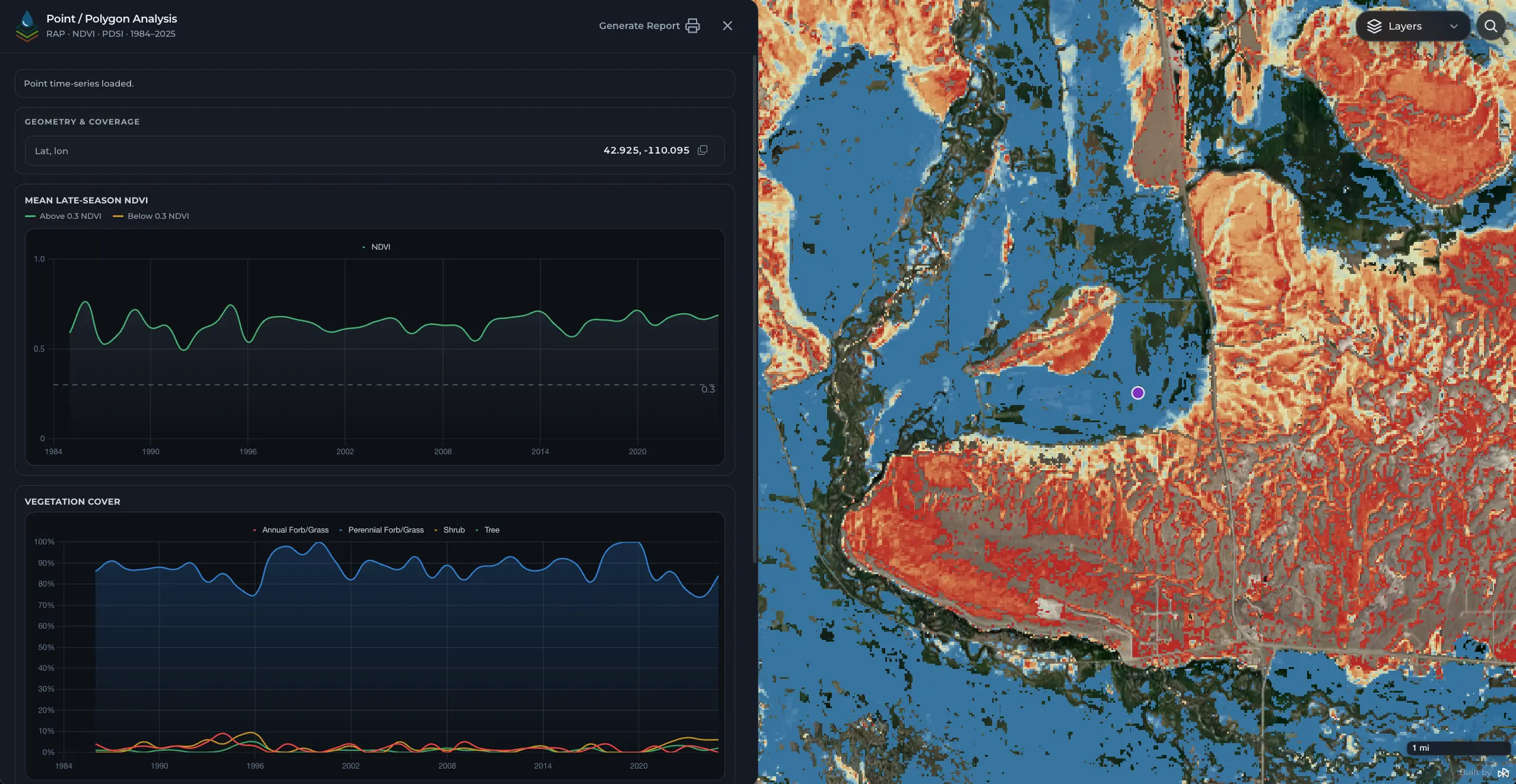
See where productive herbaceous vegetation persists across the biome — in wetlands and in drought-resistant uplands alike. Explore 40 years of vegetation dynamics alongside drought history and land ownership.
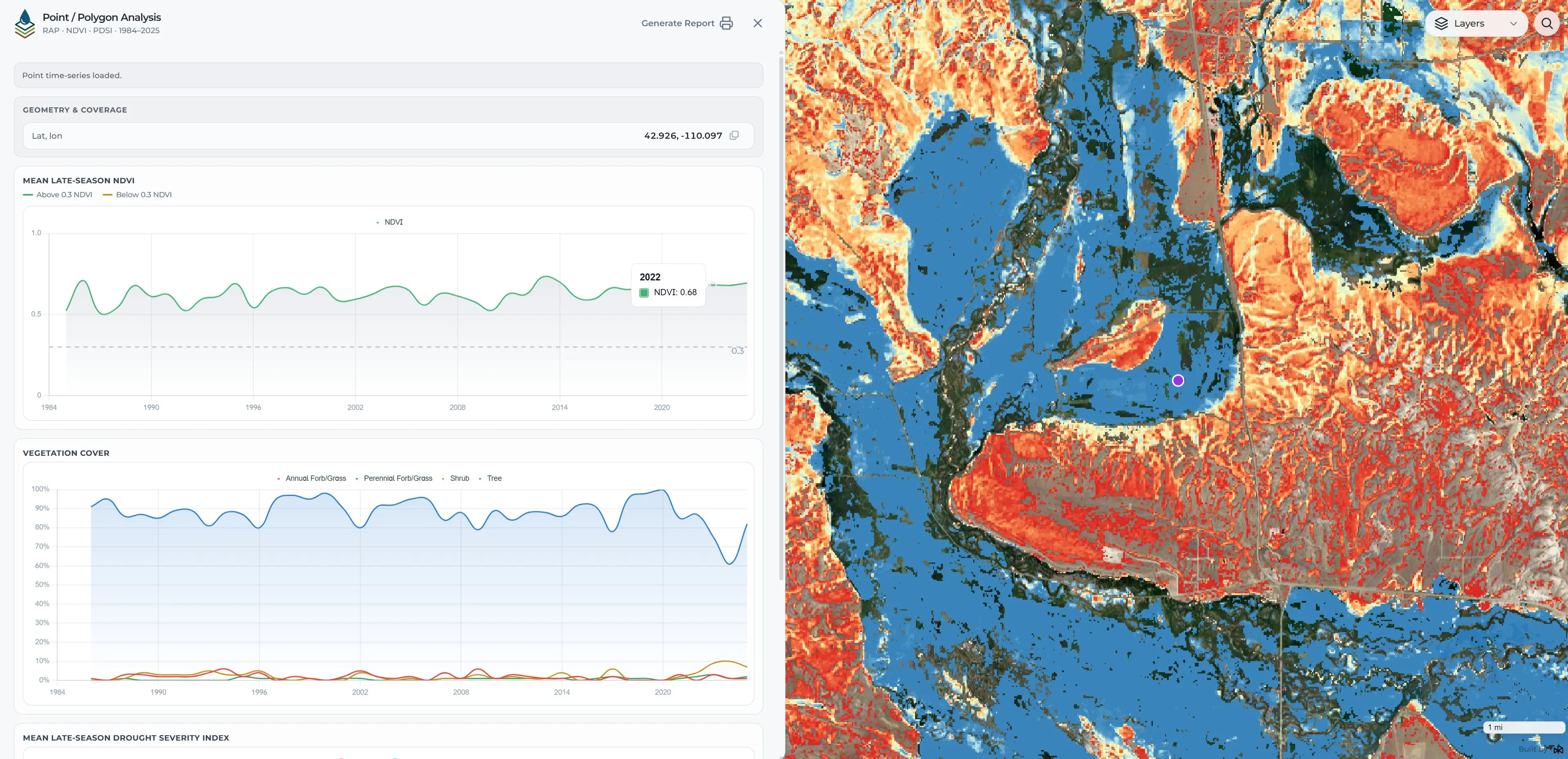
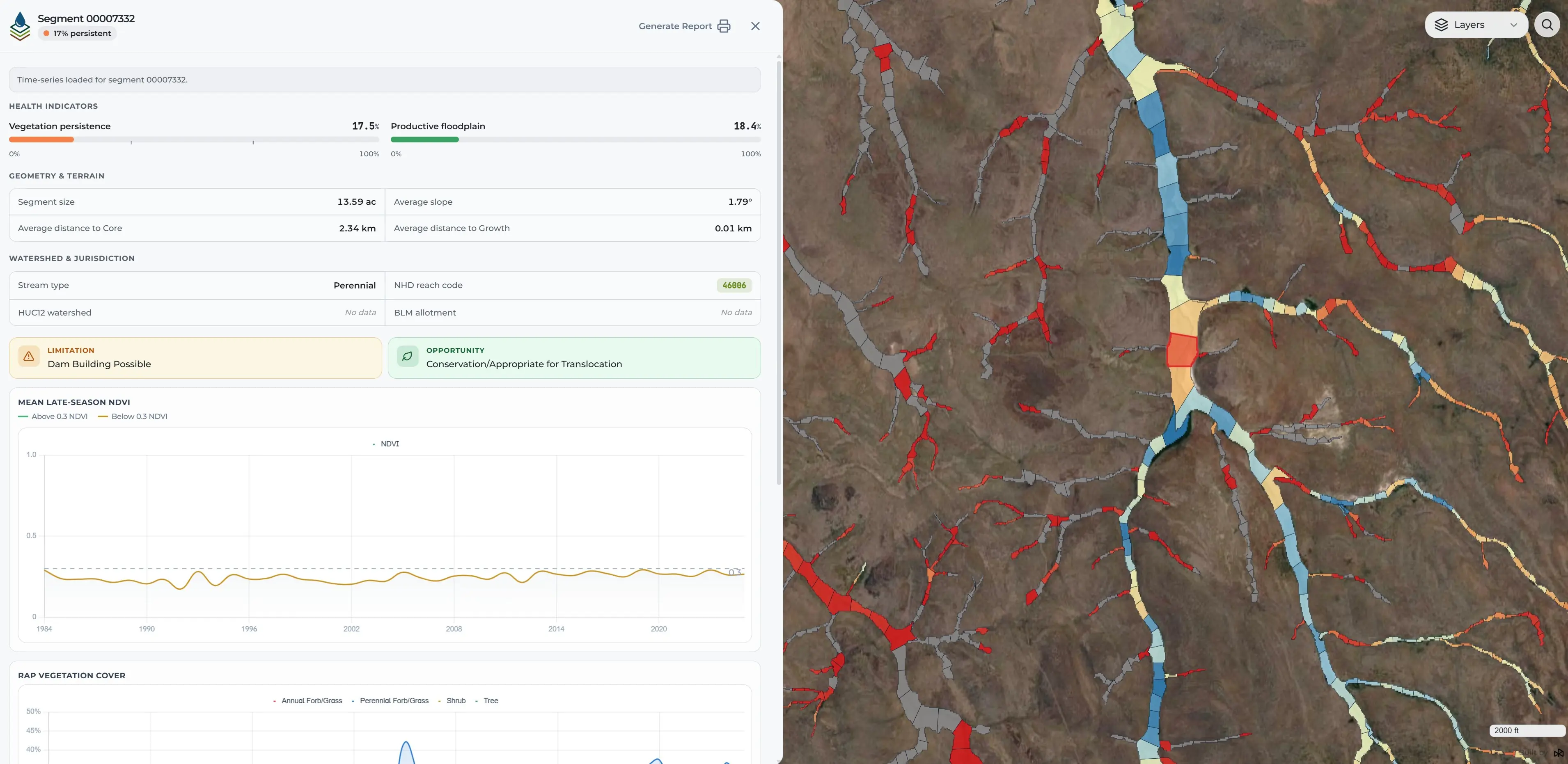
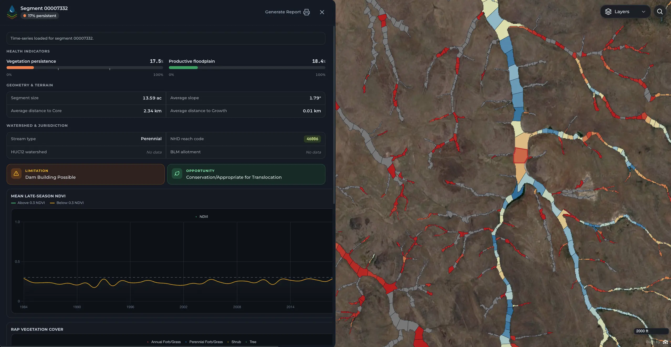
Assess on-the-ground conditions within valley bottoms and stream corridors. Evaluate vegetation, greenness, floodplain connectivity, and multi-decadal climate signals
Platform outputs
What You Can See And Analyze
Explore 40+ years of mesic conditions through time-series data, mapped layers, and reach-level summaries.
Time-Series Data
Track how conditions change over time.
NDVI, vegetation cover, and drought severity (PDSI) from 1984–2025, available for any point, field, or reach.
Vegetation Composition
Understand what's actually on the ground.
Breakdowns of perennial and annual grasses/forbs, shrubs, and tree cover across space and time.
Mesic Persistence Mapping
See where water-driven systems hold over time.
Percent-of-years productive vegetation layers reveal stable mesic areas in water-limited landscapes.
Landscape Context Layers
Place data in real management context.
Public and protected lands, BLM allotments, habitat designations, and Sagebrush Conservation Design tiers.
Watershed & Prioritization Layers
Identify where to focus effort.
HUC12 watershed rankings, long-term persistence trends, and conservation prioritization outputs.
Reach-Level Summaries
Get detailed metrics for any valley bottom segment.
Slope, floodplain connectivity, vegetation persistence, stream type, and distance to core sagebrush areas.
Brought to you by

PROJECT PARTNERS
Your data stays yours
Built For Sensitive Data
Designed for partners working with privileged landowner data. Uploaded boundaries are encrypted in transit and never stored — when your session ends, the data is gone. All calculations are performed on demand. No saved fields, no stored geometries, no hidden state.
Launch Application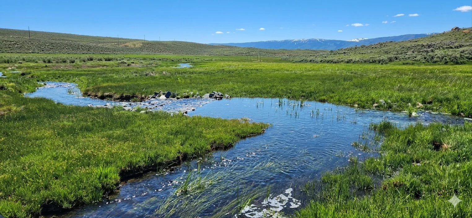
Prioritize Landscapes For Lasting Resilience.
Identify, score, and act on the highest-impact restoration opportunities across the sagebrush biome. Backed by science, built for partners.
© 2026 Working Lands for Wildlife. All rights reserved.